Research led by Loïc Denis, MCF HDR, Hubert Curien laboratory, Image Science & Computer Vision team.
Synthetic Aperture Radar (SAR) imaging is an active imaging technique that can be used day and night to “see” through clouds. It involves emitting an electromagnetic wave of centimetric wavelength and recording the echoes returned from the ground.
Radar imagery is increasingly used in Earth observation. The wealth of information contained in these images (polarimetric and interferometric information) and the different response of the environment compared to optical wavelengths, enable us to better monitor the evolution of our planet. At Télécom Saint-Etienne, work has been carried out to study tropical forests (in preparation for the European BIOMASS satellite mission, to be launched in 2022), characterize the urban environment (in collaboration with Télécom Paris, ONERA and the University of Rennes) and monitor freshwater reserves in lakes and rivers (in preparation for the CNES-NASA SWOT satellite mission, to be launched in 2021).
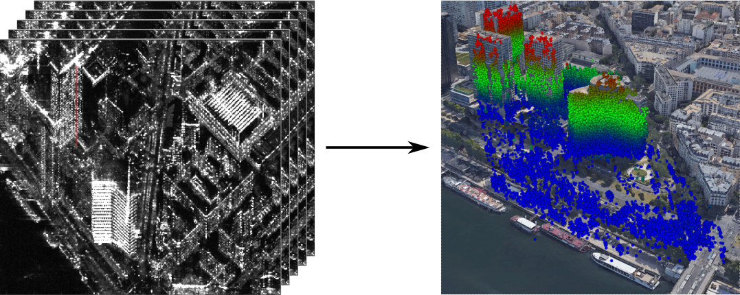
Radar tomography combines several images (typically between 4 and a few dozen) and reconstructs three-dimensional information by analyzing the phase shift seen by different radar antenna positions.
Exemple de reconstruction de données tridimensionnelles grâce à la tomographie radar