Research area: Satellite radar imagery as a tool for Earth observation
Loïc Denis, MCF HDR, Hubert Curien laboratory, Image Science & Computer Vision team
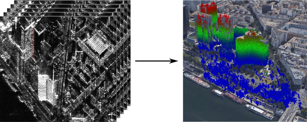
Synthetic Aperture Radar (SAR) imaging is an active imaging technique that can be used day or night and allows one to “see” through clouds. It consists of emitting an electromagnetic wave of centimetre wavelength and recording the echoes returned from the ground.
Radar imagery is increasingly used in Earth observation. The wealth of information contained in these images (polarimetric and interferometric information) and the different response of the environment compared to optical wavelengths makes it possible to better monitor the evolution of our planet. At Télécom Saint-Etienne, work has been carried out on the study of tropical forests (preparation of the European BIOMASS satellite mission, to be launched in 2022), the characterization of the urban environment (in collaboration with Télécom Paris, ONERA and the University of Rennes) and the monitoring of fresh water reserves in lakes and rivers (preparation of the CNES-NASA SWOT satellite mission, to be launched in 2021).
Radar tomography combines a few images (typically between 4 and a few dozen) and reconstructs three-dimensional information by analysing the phase shift seen by the different positions of the radar antenna.